Pakistan set to declare India's 'integral part' Gilgit-Baltistan as 5th province

March 16, 2017

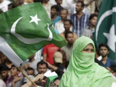
Islamabad, Mar 16: In a move that may raise concerns in India, Pakistan has announced that it is planning to declare the strategic Gilgit-Baltistan region as its fifth province.
BaltistanThe Gilgit-Baltistan area is Pakistan's northernmost administrative territory that borders the disputed Pakistan-occupied Kashmir.

India also claims the Gilgit-Baltistan area as its own – the map of Jammu and Kashmir features the area as part of India – however, the claim lost its potency after Kashmir became the biggest cause of friction between the two nations.

The Gilgit-Baltistan occupied by Pakistan covers 85,793 sq km and is treated as a separate geographical entity by Pakistan. It has a regional assembly and an elected chief minister.

The area was divided in 1970 into two: Mirpur-Muzaffarabad (Pakistan-occupied Kashmir) and the Federally Administered Gilgit-Baltistan (It is also referred to as the Northern Areas).

In 1963, Pakistan illegally ceded the Shaksgam Valley of Gilgit-Baltistan to China in a 1963 border agreement.

The area is significant to both Pakistan and China as the $46 billion China-Pakistan Economic Corridor (CPEC) passes through the region.

Pakistan's Minister for Inter-Provincial Coordination Riaz Hussain Pirzada told Geo TV that a committee headed by advisor of foreign affairs Sartaj Aziz had proposed giving the status of a province to Gilgit-Baltistan.

"The committee recommended that Gilgit-Baltistan should be made a province of Pakistan," Pirzada said on Wednesday.

He also said that a constitutional amendment would be made to change the status of the region, through which the CPEC passes.

Balochistan, Khyber Pakhtunkhwa, Punjab, and Sindh are four provinces of Pakistan.

Last year, the then MEA official spokesperson Vikas Swarup, responding to a question regarding reports that Pakistan is making Gilgit-Baltistan its province, said the entire state of Jammu and Kashmir, which includes areas currently under Pakistan occupation, is an integral part of the Union of India.

India has maintained that entire area is its integral part by virtue of its accession in 1947.

Comments

Add new comment

  • Coastaldigest.com reserves the right to delete or block any comments.
  • Coastaldigset.com is not responsible for its readers’ comments.
  • Comments that are abusive, incendiary or irrelevant are strictly prohibited.
  • Please use a genuine email ID and provide your name to avoid reject.
Agencies
August 3,2020

Manila, Aug 2: The number of COVID-19 cases in the Philippines has exceeded the 100,000 marks with a record 5,032 new infections registered on Sunday, the Health Ministry's data showed.

With the total cases now reaching 103,185, the spread of COVID-19 in the Southeast Asian nation is steeply rising. The daily growth rate just this Thursday set a record at over 3,800 cases, the next day there were nearly 4,000 new infections detected and on Saturday, over 4,800 cases were detected.

More than 65,000 people have recovered from the ailment, while 2,059 people have died.

The Philippines' epidemiological dynamic mirrors that of many Southeast Asian nations, where COVID-19 infections have only recently begun to climb. 

Most other nations in Europe and the Americas experienced an initial spread of the virus which later tailed off only to begin climbing again after easing of restrictions.

Comments

Add new comment

  • Coastaldigest.com reserves the right to delete or block any comments.
  • Coastaldigset.com is not responsible for its readers’ comments.
  • Comments that are abusive, incendiary or irrelevant are strictly prohibited.
  • Please use a genuine email ID and provide your name to avoid reject.
News Network
July 24,2020

Kathmandu, Jul 24: At least 132 people lost their lives as a result of heavy rains triggering landslides, and flash floods in Nepal.

"132 people dead, 128 injured, 53 missing and 998 families affected due to rainfall, landslides and floods in the country as of 23rd July," Nepal Disaster Risk Reduction and Management Authority Within the last two weeks, the Myagdi district of western Nepal was the worst affected with 27 reported deaths.

Search and rescue operations are being conducted continuously with officials and police personnel who are looking through the debris to find missing people.

Monsoon-induced disasters are common in Nepal owing to the country's mountainous topography. Hundreds have been displaced as landslides have swept away their homes. They ended up taking refuge in local schools and community centers.

Nepal's Meteorological Forecasting Division earlier last week had predicted heavy downpour across the country. The Division had warned of monsoon winds being near the low-pressure line in the Terai belt, which would consequently cause more rainfall.

Comments

Add new comment

  • Coastaldigest.com reserves the right to delete or block any comments.
  • Coastaldigset.com is not responsible for its readers’ comments.
  • Comments that are abusive, incendiary or irrelevant are strictly prohibited.
  • Please use a genuine email ID and provide your name to avoid reject.
coastaldigest.com web desk
June 18,2020

Kathmandu, June 18: Nepal's National Assembly on Thursday unanimously passed the Constitution Amendment Bill to update the country's political and administrative map incorporating three Indian territories. 

The new map also includes land controlled by India. It requires President Bidhya Devi Bhandari's approval.

India, which controls the region - a slice of land including Limpiyadhura, Lipulekh and Kalapani areas in the northwest - has rejected the map, saying it is not based on historical facts or evidence.

India has termed as untenable the "artificial enlargement" of territorial claims by Nepal after its lower house of parliament on Saturday unanimously approved the new political map of the country featuring areas which India maintains belong to it.

The National Assembly, or the upper house of the Nepalese parliament, unanimously passed the constitution amendment bill providing for inclusion of the country's new political map in its national emblem.

The bill was passed with all the 57 members present voting in its favour.

The dispute

The latest border dispute between the countries began last month after India inaugurated Himalayan link road built in a disputed region that lies at a strategic three-way junction with Tibet and China.

The 80km (50-mile) road, inaugurated by Indian Defence Minister Rajnath Singh, cuts through the Lipulekh Himalayan pass, considered one of the shortest and most feasible trade routes between India and China.

The road cuts the travel time and distance from India to Tibet's Mansarovar lake, considered holy by the Hindus.

But Nepal says about 19km of the road passes through its area and fiercely contested the inauguration of the road, viewing the alleged incursion as a stark example of bullying by its much larger neighbour.

Nepal, which was never under colonial rule, has long claimed the areas of Limpiyadhura, Kalapani and Lipulekh under the 1816 Sugauli treaty with the British East India Company, although these areas have remained under the control of Indian troops since India fought a war with China in 1962.

Comments

Angry indian
 - 
Sunday, 21 Jun 2020

acche din after deshbakth become ruling party...now even weakist country started conquring indian..what a shame on so0 called 56 inch chest..we need tiger leader not Pm who always speak in air and lie alot..


this is how an hindu nation is build ? Bjps cant rule india for more than 10 year...

Add new comment

  • Coastaldigest.com reserves the right to delete or block any comments.
  • Coastaldigset.com is not responsible for its readers’ comments.
  • Comments that are abusive, incendiary or irrelevant are strictly prohibited.
  • Please use a genuine email ID and provide your name to avoid reject.